Here Stands the Ruth Anne Dodge Memorial Known as the Black Angel

Here Stands the Ruth Anne Dodge Memorial Known as the Black Angel

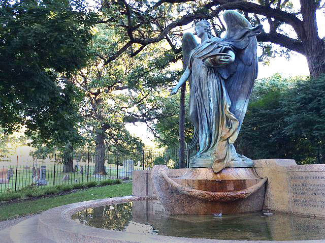
High atop a ridge overlooking the Missouri Valley is Council Bluffs’ Fairview Cemetery, where stands the Ruth Anne Dodge Memorial, also known as the Black Angel. Legend has it the spot is haunted and visitors sometimes report unusual occurrences. Nevertheless, the site is worth a visit as the beautiful bronze sculpture, listed on the National Register of Historic Places, is the work of Daniel Chester French, who created Washington D.C.’s Lincoln Memorial and the minuteman in Concord, Massachusetts.

Ruth Anne Dodge was the wife of railroad baron General Grenville Dodge, an honored figure in the history of Council Bluffs and the westward expansion of the railroad. 

The Ruth Anne Dodge Memorial Known as the Black Angel

Born in 1833 in Peru, Illinois, into a family that could provide a ladies’ education, she was a multi-talented woman. Ruth Anne could not only play piano and write poetry, she could ride a horse and shoot a gun with the best of them, a talent that held her in good stead during the years she joined her husband on the prairies of Nebraska.

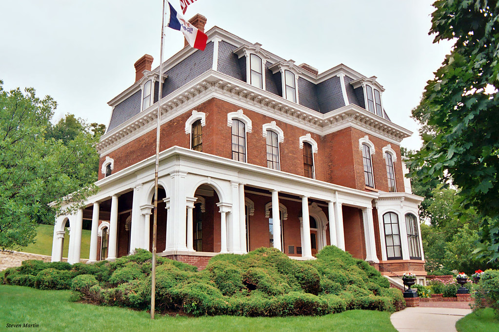
Ruth Anne and General Greenville Dodge House in Council Bluffs, Iowa

The Dodges built a grand residence in Council Bluffs, where General Dodge influenced the development of the Union Pacific Railroad. He died in January 1916, and September of that year found Ruth Anne also on her deathbed.

After her death, Ruth Anne’s daughters, Anne Dodge and Eleanor Dodge Pusey, had the sculpture made to depict the series of three nighttime visions experienced by their mother before she died. Ruth Anne had told them of the recurrent visions where she found herself on a rocky shore when through the mist she saw a small boat approach, carrying a beautiful angel holding a small bowl with water flowing forth. 

Each night the angel encouraged Ruth Anne to drink the water. “Drink, I bring you both a promise and a blessing,” the angel said. Twice Ruth Anne refused to drink, but the third night she did drink the water, and after partaking she said she felt “transformed into a new and glorious being,” telling her daughters she had drunk the “water of life” and now had immortality. She died a short time later.

Who haunts the site today is unclear. Is it Ruth Anne Dodge? Or perhaps it is the beautiful but tormented young woman who served as the model for the sculptor. According to Tom Emmett, executive director of the Historic General Dodge House in Council Bluffs, Audrey Munson was the most oft-sculpted woman of her time.

Ruth Anne Dodge Memorial

But apparently, fame did not bring her happiness, for a decade after modeling for the artist she tried to commit suicide and was subsequently committed to an insane asylum, where she lived another 65 years without visitors, dying at the age of 104.

Emmett says some people believe that those who touch the sculpture may be cursed. Others say the angel flies off her pedestal at night, and still others say the angel’s eyes follow a person as they walk past. One way to find out is to go and visit. The sculpture is considered likely the most valuable artwork in Council Bluffs, and it is just steps from a spectacular view of the Missouri River Valley and the expanse of Nebraska beyond.

“The Black Angel of Council Bluffs: The Ruth Anne Dodge Memorial.” Spiritual Travels: Practical Advice for Soulful Journeys. Accessed Oct. 15, 2023.

“Ruth Anne Dodge Memorial – The Black Angel.” History Online, The Historical Society of Pottawattamie County. Accessed Oct. 5, 2023.

Williamson, Zach. “The History, and Haunting, of Council Bluffs’ Black Angel.” KMTV 3 News Now, Local News, Oct. 15, 2022.

Ten Things I Didn’t Know About Rolle Bolle

Ten Things I Didn’t Know About Rolle Bolle

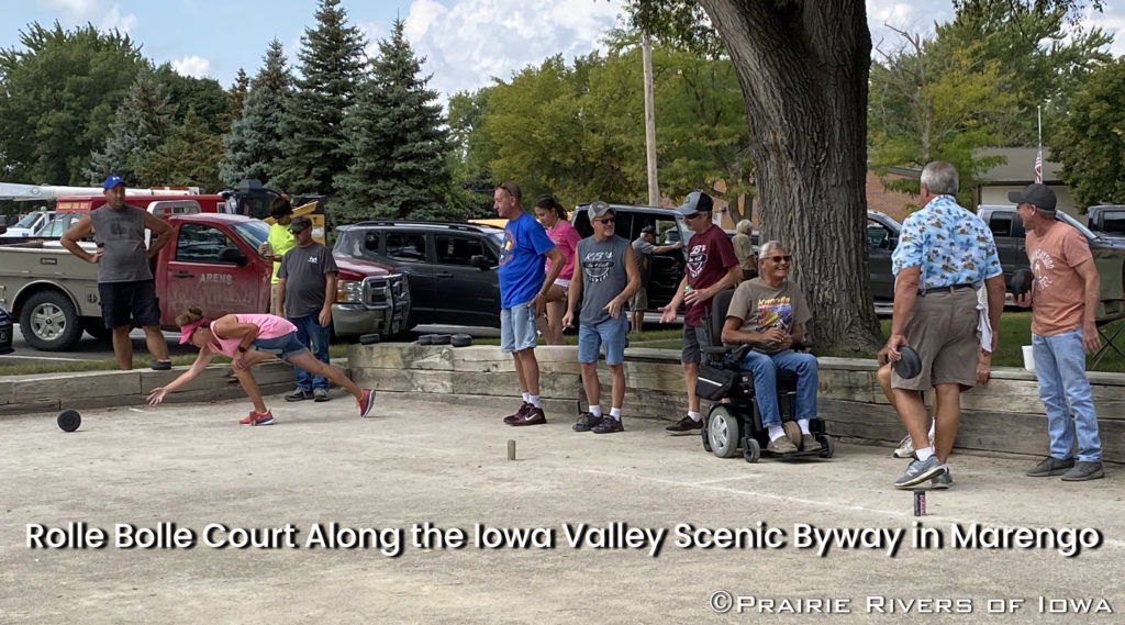
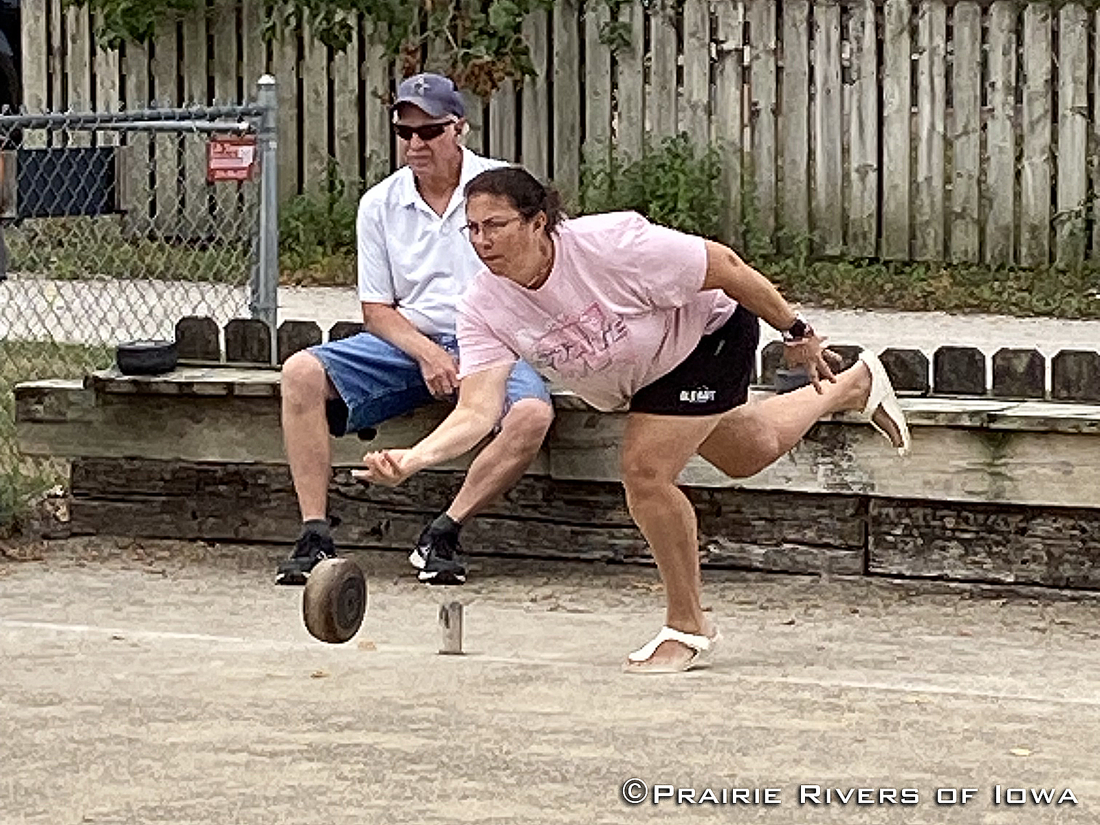
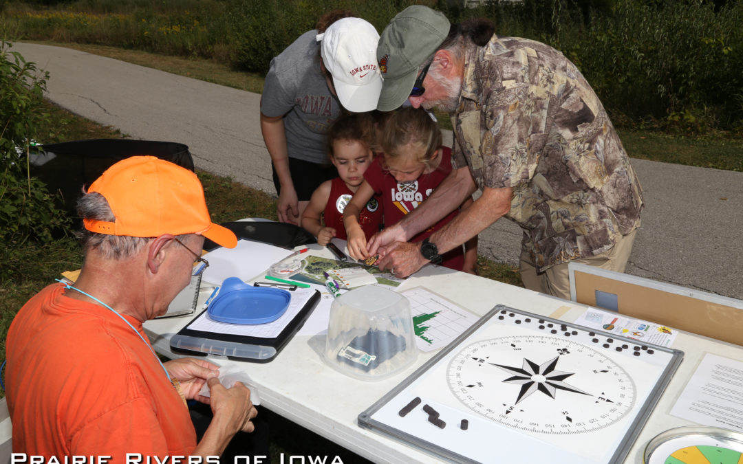
Recently, I had the opportunity to hang out with the group of Rolle Bolle enthusiasts who play this game every weekend of the summer rotating between courts in the Iowa Valley, Minnesota, and Illinois. They are such a welcoming group who made me feel at home. If only I hadn’t been fighting a cold at the time, I would have accepted the beverage of Rolle Bolle choice and then been able to call myself family. This truly felt like a family sport, not only because there was a mom, dad, and daughter playing, and many of them were related, but because they encouraged each other, gave tips, and maybe had a little bit of rivalry.

Recently, I had the opportunity to hang out with the group of Rolle Bolle enthusiasts who play this game every weekend of the summer rotating between courts in the Iowa Valley, Minnesota, and Illinois. They are such a welcoming group who made me feel at home. If only I hadn’t been fighting a cold at the time, I would have accepted the beverage of Rolle Bolle choice and then been able to call myself family. This truly felt like a family sport, not only because there was a mom, dad, and daughter playing, and many of them were related, but because they encouraged each other, gave tips, and maybe had a little bit of rivalry.

Those of you who have grown up in the Iowa Valley have most likely heard of Rolle Bolle and know how the game is played. For this central Iowan, I had never heard of the game and was quite surprised by many details I hadn’t noticed just by viewing the game in photos.

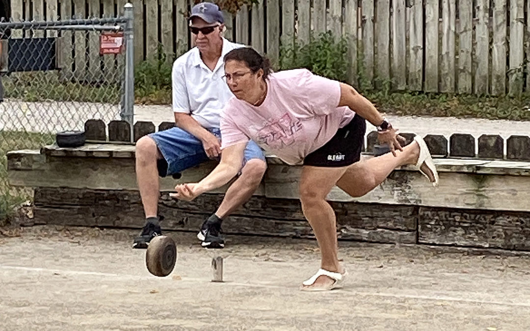
In simplistic terms, the game is played by teams of three or four people rolling bolles down an alley aiming to land their bolles closest to a pole. The object is to have the most bolles* the closest distance to the pole than the other team by the end of everyone’s turn.

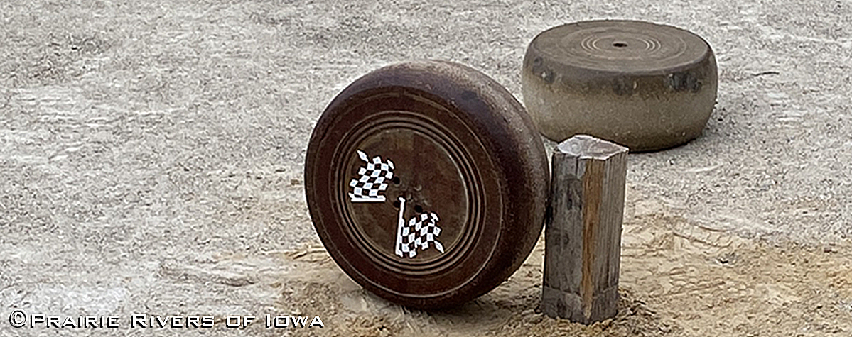
*One of the defining characteristics of Rolle Bolle is the beveled wheel-like shape of the ball or bolle. Bolles are manufactured in a way so that they do not roll straight but in a curved, elliptical path.

Bolle

The 10 Things I Learned 

1: Although the bolle looks like a greatly enlarged hockey puck to me, it is not the same diameter on each side. I even rolled the bolle down our hallway here at Prairie Rivers and did not notice that there is a smaller side and a larger side. So why the beveled shape? The origin of the shape is not known; a fun theory is that the first bolle was a wheel of Gouda cheese, although this is probably not true. Whatever the origin, the shape is what makes the game unique to horseshoes, bocce, bowling, or curling.

2: There is not a one-size-fits-all regulation size for the bolle. Although they can weigh no less than five and no more than 9.5 pounds and measure no larger than 8” in diameter, they can be different for each player. Doesn’t this give someone with a larger bolle an advantage of being closer to the pole? “Not really,” I am told. A smaller bolle may be able to creep between thrown bolles better, a larger one may be lighter and more easily bumped out of position. What it boils down to is the boller knowing their bolle’s weight and turn and their aim, strategy, skill, and luck. 

3: Bolles are not all made of the same material. Nineteenth-century bolles were made from ironwood, a hard dense type of wood. Fiberglass has also been used. Belgian bolles today are mostly made of phenolic resin which produces a lighter and chip-resistant bolle. Most bolles in the United States are made from rubber and there are only two makers in the United States. One of those makers, De Pauw, makes bolles that are rubber in the center and phenolic material on the outside; he calls it the “Wonder Bolle.”

4: Just as there isn’t one regulation size or material for the bolles, there isn’t a regulation for the material or slope of the courts. The court must be 42’ long with two stakes placed 6’ from the backstop (30’ between stakes). Most of the outdoor alleys are crushed limestone material that may get rolled before a tournament in an attempt to smooth it out. Alleys can also be made from clay, dirt, sand, grass, or even carpet (usually on an indoor court). And the slope can range from court to court, which as you can imagine will change the way you roll the bolle. Remember that beveled shape?

5: The backstops must be 6’ from the pole but a barrier behind the backstop can be any distance. Think of a pit with railroad ties surrounding it. The distance from the backstop line (which your foot can cross but not go over while throwing) and the railroad tie can be different and depending on the length of your legs, this can give you space to take a “running” start or hinder your pace and form when aiming the bolle. One particular boller who has long legs was starting his run cross-legged. When I asked why, he explained that he has to start his approach this way because if the backcourt is shorter, he can’t get a comfortable approach. So by starting cross-legged, he can step out giving him more space to then take his next steps. 

6: You can roll the bolle or you can shoot it! Shooting the bolle is exciting. Perhaps I see it that way because everyone kept telling me to “step back” and “heads up.” Or because the young man shooting kept breaking the poles. Or just maybe, because when I tried to roll the bolle, it went way too far (I have too much power behind my bolle roll). “Just roll it,” I was told while I was thinking, “I am.”

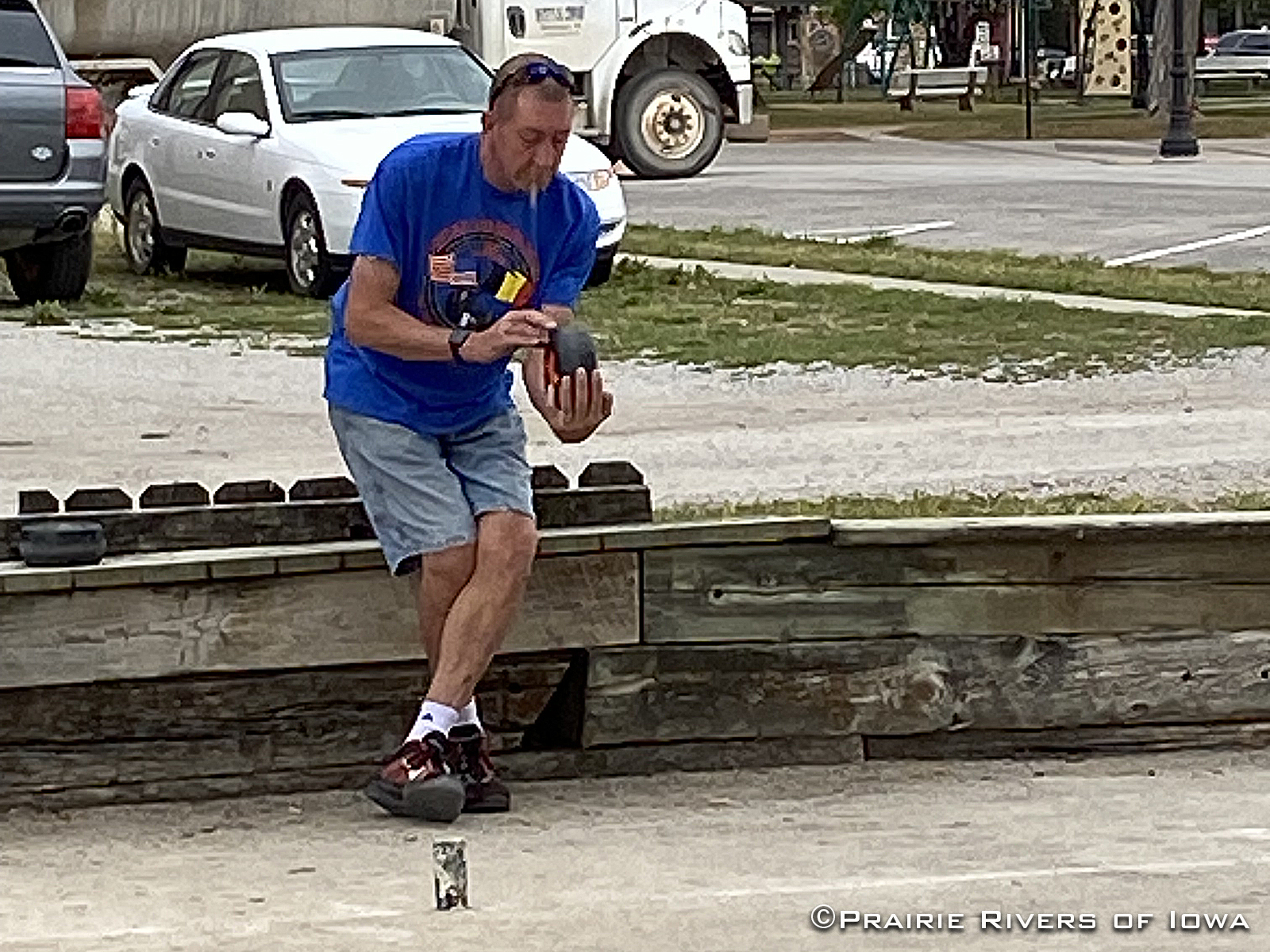
There are typically three types of players with different roles. The “lead person,” the middle person (no official name), and the “shooter.” The lead gets to make the team’s strategic decisions. The lead and the middle person typically roll the bolle to get it close to the pole. The shooter gets to shoot at an opponent’s bolle to knock it out of the area closest to the pole, or at a teammate’s bolle to knock it closer. More power is used when shooting. And a “step back” is shouted to the crowd.

7: There are Rolle Bolle courts in Belle Plaine, Marengo, Victor, Ladora, Blairstown, and Marion. And several have closed in just the last three years.

8: Bollers have a love-hate relationship with the game. One boller I visited with kept saying, “I hate this game.” Then he would tell me that he tries to play the game seven days a week. He was the only player from Illinois this weekend. After explaining that you can’t master this game because of all the variables, all of the bollers expressed how they love it. A love-hate for sure!

 9: This “thing” about Rolle Bolle is something that I know, and you may not know. Did you know that with a library card, you can check out a set of Rolle Bolle bolles at the Marengo Public Library? Yep.

10: This is not the last time that I will be writing about Rolle Bolle. smile

Boller Starting His Run Cross-Legged
Not One Size Fits All
Rolling the Bolle

Thank you to all of the Rolle Bolle bollers who were at the Marengo Court on September 16th. We will continue to educate and encourage a new generation of bollers to carry on your legacy.  — Jeanie

Five Stages of Watershed Awareness

Five Stages of Watershed Awareness

October is Watershed Awareness Month, by proclamation of Story County Conservation Board and city councils in Ames, Nevada, and Gilbert. Okay, so what exactly do we want people to be aware of? I would suggest the following progression…

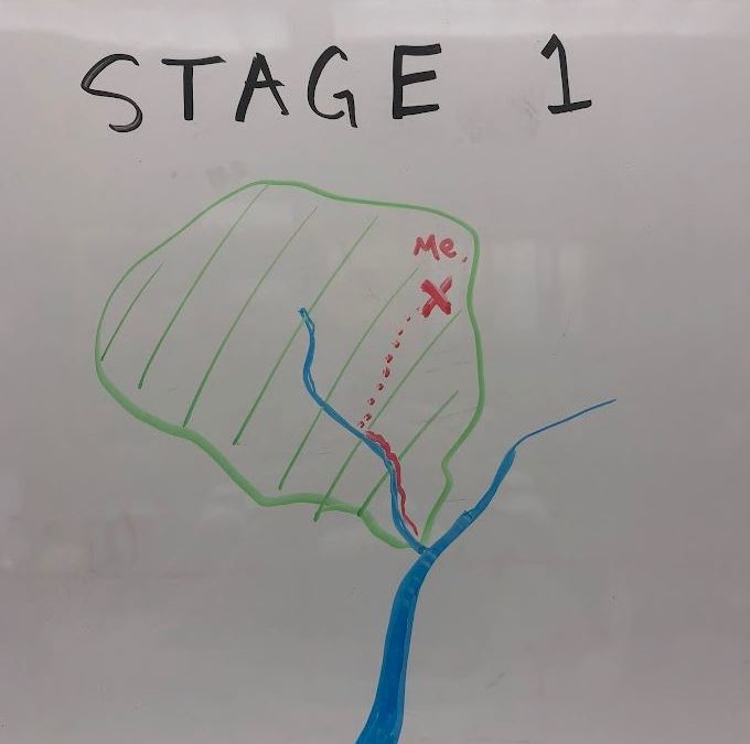
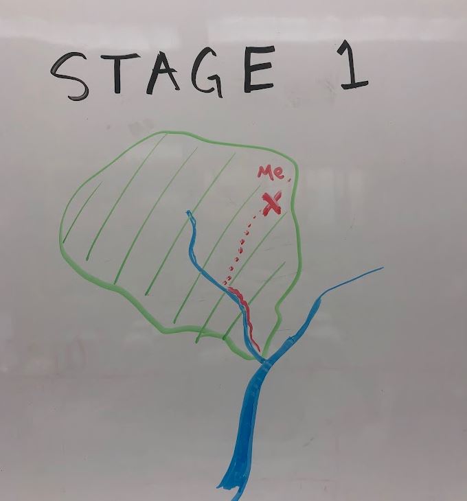
Stage 1 of watershed awareness

Stage 1: What’s a watershed?  Who cares?

A watershed is the land area that drains to a common outlet. Imagine a river valley between two mountain ridges. Now replace that mental image with gentle hills–we’re in Iowa. But more important than knowing the definition is understanding why it’s important: because water flows downhill, actions on land can have consequences for downstream water bodies.

Perhaps the best illustration of this principle is an incident from 2020. Following a power outage, some Hy-Vee employees in Ankeny poured 800 gallons of spoiled milk down a storm sewer, turning the nearby creek white, killing 2,000 fish, and costing their employer almost $25,000 in fines and restitution. The silver lining of this boneheaded decision was that it made the news and reminded many Iowans that yes, storm sewers drain to rivers (usually without any treatment) and so we should think twice about what we pour or let wash in. The same principle applies to ditches, gullies, and drainage tiles.

Want a more positive framing? Watch this one-minute video we created with the City of Ames about the South Skunk River, and how cities and farms in the watershed can make a difference.

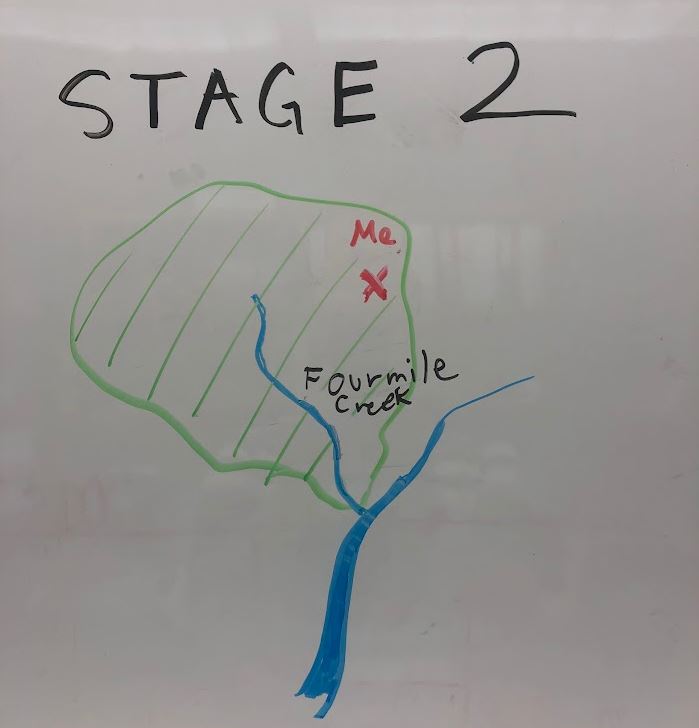
Stage 2 of watershed awareness.

 Stage 2: What’s my watershed(s)?

It’s one thing to know that my actions could (in principle) help or harm some downstream water body. It’s another thing to know that what goes down my neighborhood storm drain ends up in Ioway Creek at Brookside Park, a place where I’ve taken my kids to play. In 2018, we partnered with Story County Conservation to put up watershed and creek signs, in hopes that more people make those kinds of connections.

Creeks flow to rivers and rivers flow to the sea (except in endorheic basins) so we live in multiple, nested watersheds.  A convenient way to represent this is with the US Geologic Survey’s Watershed Boundary Dataset, which has mapped American watersheds at six levels and assigned them each a unique hydrologic unit code (HUC).  You can look up your “watershed address” with our interactive map.  For example, that grocery store in Ankeny is in the lower Fourmile Creek watershed, within the watershed of Red Rock Lake, within the watershed of the Des Moines River, and within the upper part of the giant Mississippi River basin.

Watershed awareness, stage 3

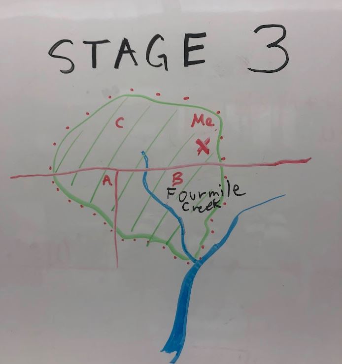
Stage 3: Who are the other people in my watershed?

One reason to learn which watershed you live in is to connect with other people who are concerned with flooding, water quality, fisheries, and recreation.

Twenty-eight watersheds in Iowa have a Watershed Management Authority with representatives from local governments in the watershed (cities, counties, and soil and water conservation districts) who might collaborate on water quality or flood control projects.  Fourmile Creek WMA is one of the more active WMAs; its member jurisdictions pooled money to hire a watershed coordinator who can work with farmers and landowners.  In some watersheds, farmers and landowners have access to additional cost-share programs or receive higher priority when they apply.

In some watersheds, a volunteer group, land trust, or other non-profit organization organizes projects to protect the water or raise public awareness.  For example, the lake at Ada Hayden Heritage Park in Ames has a friends group, while the Raccoon River has a volunteer Watershed Association in addition to three WMAs.

Caveat

Unfortunately, I’m not aware of any central clearing house where one can find out what groups and projects are active in your watershed. I’m also not aware of any plans by state leaders to provide WMAs with stable funding or to delegate to them any powers that would help them accomplish their tasks. Watershed projects tend to be grant-funded (and thus short-lived) and watershed coordinator jobs often have high turnover.

Stage 4 of watershed awareness

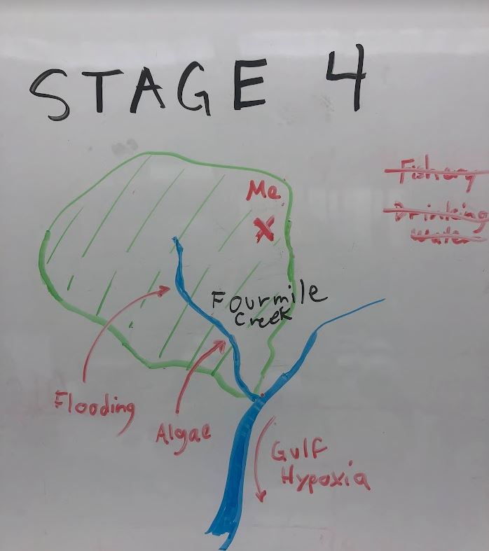
Stage 4: What are the issues in my watershed?

Some watersheds have management plans (like this one for Fourmile Creek) that identify creek- or lake-specific problems and solutions. However, in many cases, the data needed to evaluate a problem and track progress toward solutions is missing until volunteers, universities or local government step up to do monitoring.

Knowing which issues go with which watershed can help us prioritize and find solutions.

  • Not every stream has the right conditions to support a trout fishery (like Bloody Run in Clayton County).
  • Not every stream has a history of destructive floods (like Fourmile Creek in Polk County).
  • Not every lake or reservoir has suffered from toxic algae blooms (like Brushy Creek Lake in Webster County).
  • Not every river is deep enough and has access for canoeing (like the South Skunk River in Story County).
  • Not every river affects the supply and safety of drinking water for thousands of people (like the Raccoon and Cedar rivers).
Stage 5 of watershed awareness

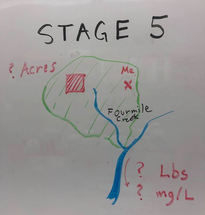
Stage 5: How big are the problems and solutions in my watershed?

The most difficult thing to understand about a watershed is the scale.  It helps to have some familiar reference points.  Here are some of mine.  (I’ve used an app that makes it easy to delineate a watershed for any point of interest.  The area is rounded to the nearest 100 acres.)

  • 1,000 acres: Creek at Tedeco Environmental Learning Corridor, Ames.
  • 5,900 acres: Peas Creek at the Ledges State Park.

At the HUC12 scale, most creeks are too wide to jump across, but shallow enough to wade.  Watersheds are small enough to fit in one county.

  • 14,100 acres: Walnut Creek at Neil Smith National Wildlife Refuge
  • 24,000 acres: Bloody Run at Marquette.
  • 56,800 acres: Fourmile Creek at Sargent Park in Des Moines.

At the HUC10 scale, it might be called a creek, but it often has enough water to float a canoe, and watersheds usually cross a few county and city lines.

  • 132,700 acres: Ioway Creek at Brookside Park in Ames.
  • 173,500 acres: Maquoketa River at Manchester.
  • 209,300 acres: South Skunk River at River Valley Park in Ames.
  • 356,100 acres: Rathbun Lake

At the HUC8 scale and beyond, the rivers are big and the watershed meetings can involve many jurisdictions and long drives.

  • 586,400 acres: Floyd River at Sioux City
  • 1,285,200 acres: North Raccoon River at Squirrel Hollow Park in Jefferson
  • 2,306,200 acres: Racoon River at Waterworks Park, Des Moines
  • 3,733,300 acres: Des Moines River at Saylorville Reservoir
  • 97,191,700 acres: Mississippi River at Dubuque

For each of these watersheds, you’d need to plant about a third of the cropland to cover crops to reduce nitrogen and phosphorus in the stream by 10%.  Most watershed plans will include more ambitious long-term goals and more complicated scenarios to achieve them, but this is a handy benchmark for thinking about the scale of change needed.  Reaching the 1/3 mark for cover crops in a watershed would be good progress toward our 45% nutrient reduction goals and could produce a big enough improvement in water quality in the stream that we could conceivably measure it, though maybe not with test strips (i.e. from 10 to 9 mg/L of nitrate, from 0.40 to 0.36 mg/L of total phosphorus).

I don’t mean to discourage anyone, but I’m not aware of any watershed project in Iowa that has achieved success on this scale.

How to Have a Delightful Halloween Hike

How to Have a Delightful Halloween Hike

As the rays of summer creep towards the embers of autumn, now is a great time to go on a long walk to breathe in the changing of the seasons. While most people will be putting up lights and hoarding candy for Halloween, you can hit the trails to see some of the most interesting and spooky beings found naturally, right here in Iowa! Here we compile all things October to give you the best time to hike, where to find fairy fires and ghostly plants, and facts about curious birds this autumn.

Fantastic Foliage and When to Find It

To enjoy the best fall leaf display, the best practice is to go for a walk each day. If this is impossible, or you love planning, check the Iowa Department of Natural Resources’ Fall Color Report online (or sign up for email updates on their report page).

Toadstools at Twilight

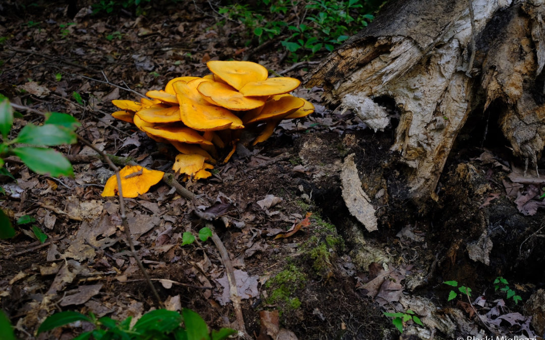
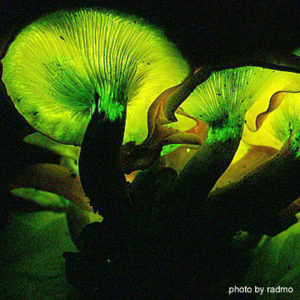
Did you know that Iowa is home to glowing mushrooms?! The Jack-O’-Lantern mushroom (Omphalotus illudens) is pumpkin-orange in daylight, and lights up at night! Its light, also called fox fire or fairy fire, is created through bioluminescence. Remember that mushrooms are merely the reproductive parts of fungi. The majority of the fungus is actually underground. To find Jack-O’-Lantern mushrooms, search forests during the day for orange, classic-shaped mushrooms at the base of trees, and then return to areas where you found them on a dark night (with a friend for safety!). Give your eyes time to adjust after you put your lights out – the glow comes from the gills (on the underside of the mushroom) and will be faint. Please don’t harvest the mushrooms – they are poisonous.

Glowing Jack-O-Lantern

Glowing Jack-O’-Lanterns on a dark night

Peculiar Plants

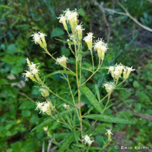
Some native plants you can see now in central Iowa, with quintessential Halloween-like names, include “false boneset,” “doll’s eyes,” and “ghost plant.” False boneset (Brickellia eupatorioides) is named for the fact that its bone-colored flowers and plant structure resemble “true” boneset flowers. However, it is in a different genus of plants. False boneset is an important late-blooming flower for pollinators, and has a fluffy white display after flowering. It also does not spread aggressively, making it a great addition to pollinator gardens.

Sweetheart Underwing Moth

False boneset in bloom

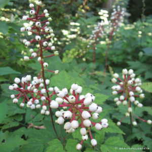
“Doll’s eyes” (white baneberry, Actaea pachypoda), is native to eastern Iowa. This small shrub produces white berries with a large black spot in the center, looking eerily like doll eyes. Adding to this eeriness, the “eyes” are poisonous to mammals, including humans. The closely related red baneberry (Actaea rubra) is native to central Iowa and sometimes produces white berries as well. Berries of both plants are eaten by birds, who don’t digest the poisonous seeds. You can find both plants in forested, shady areas with deep leaf layers.

Reversed Haploa Moth

Doll’s Eyes keep watch in the forest

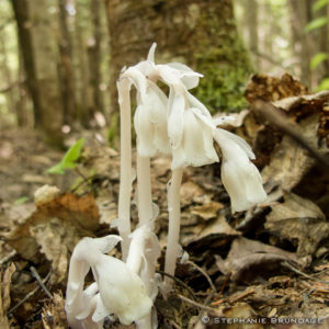
Ghost plants (Monotropa uniflora) are the star of our peculiar plant category. This plant is truly ghostly white, containing no chlorophyll (read: no green color) for photosynthesis. So how does it get its nutrients? It steals it from fungi! The fungi (specifically, mycorrhizae) share nutrients with neighboring tree roots, and the ghost plant taps into this nutrition-sharing system to help itself. October is near the end of this plant’s flowering season, but the best chances of finding it are in undisturbed forest areas with a deep organic layer.

Common Buckeye

Pale Ghost Plants on the forest floor

Alluring Animals

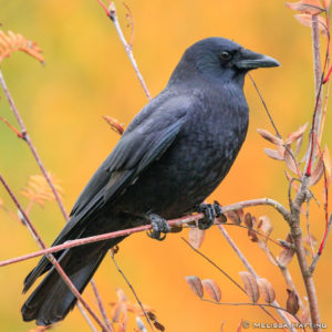
The harbinger of spooky season is the caw of the crow. Though present year-round, they are more appreciated during the twilight of the year. Seemingly ominous with their dark feathers and willingness to scavenge, these birds are in fact quite endearing. Not only are they intelligent enough to create and use tools to get food, but their offspring, once grown, normally return the next year to help tend to their younger siblings! Maybe groups of crows should be called “families” rather than “murders.” Lastly, how can you tell the difference between a crow and a raven? Firstly, ravens aren’t really found in Iowa – the closest area of their range is in northern Minnesota and Wisconsin. Secondly, the classic “caw” sound is distinctly crow, while ravens croak instead.

Swallowtail Caterpillar

A crow perches in a young tree

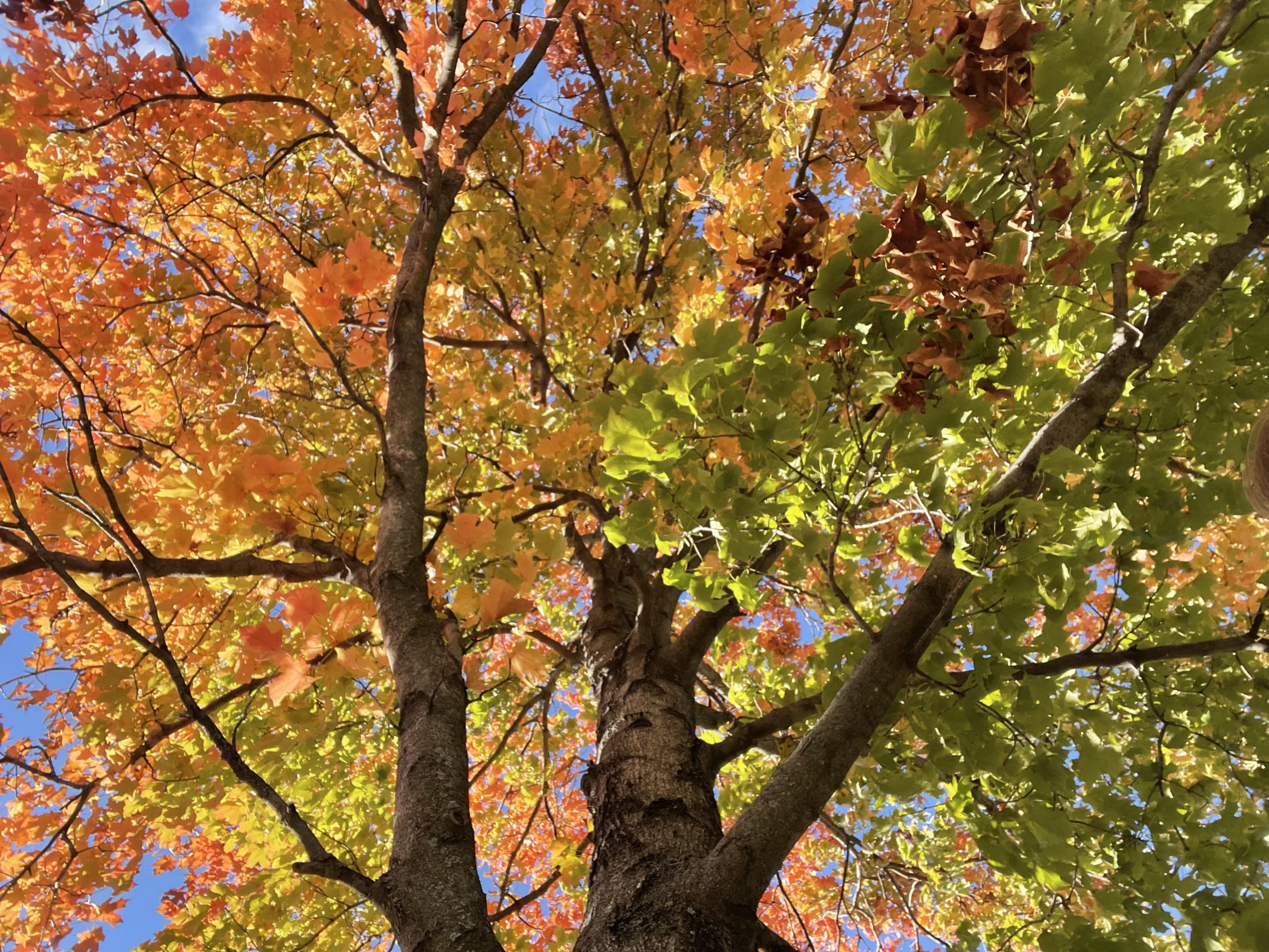
October is a lovely time of year, providing unparalleled weather and colors to enjoy Iowa’s outdoors. It is easy to agree with Aldo Leopold’s musing, that “…other months were constituted mainly as a fitting interlude between Octobers.” May you soak up this golden month of the year, and all it has to offer!

Monarch Magic in Ames Was a Day of Adventurous Fun!

Monarch Magic in Ames Was a Day of Adventurous Fun!

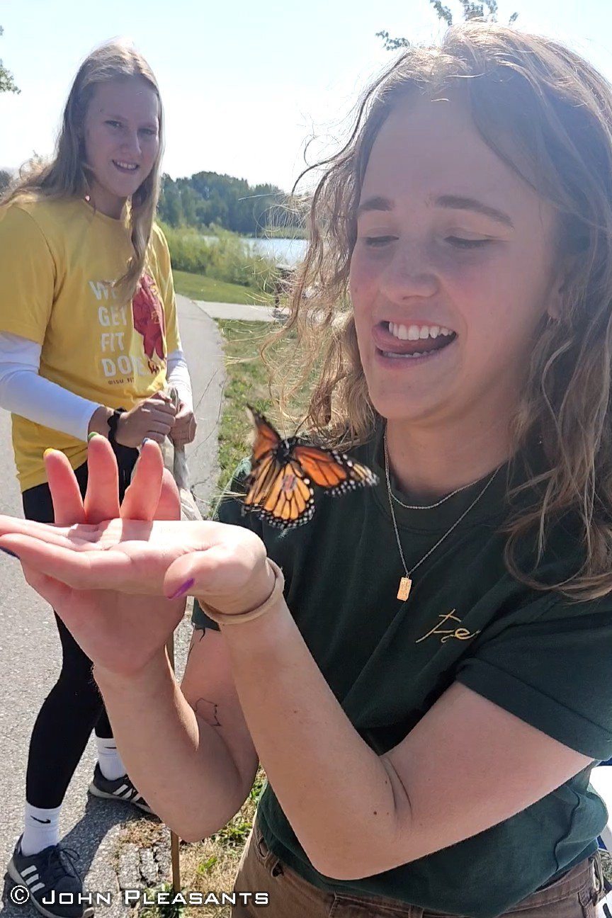
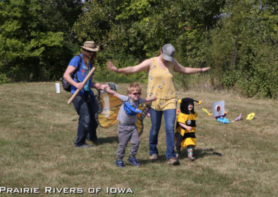
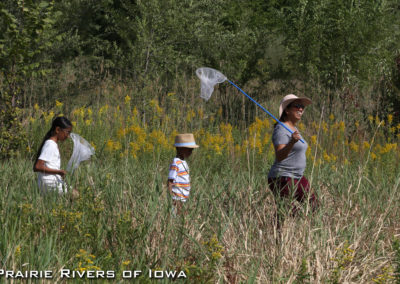
Prairie Rivers of Iowa hosted the family-friendly event Monarch Magic on Saturday, September 9, at Ada Hayden Heritage Park in Ames. Attendees had the experience of tagging a monarch butterfly to help scientists track their migration and participated in many fun activities to learn more about this butterfly and other pollinators.

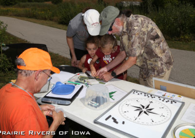
Over 300 individuals were in attendance and participated in diverse activities that ranged from navigating an obstacle course where kids had fun while learning caterpillar and pollinator survival tactics to helping local scientists and naturalists weigh, measure, tag, and release monarchs. One hundred and forty-six monarchs were tagged during the event.

Besides the primary goal of tagging monarchs to aid in tracking their migration to Mexico, pollinator education was front and center as well. Raising Readers in Story County gave away over 200 pollinator-themed books. Other partners like Story County Conservation, the Iowa Monarch Conservation Consortium, Iowa State University Extension and Outreach /4-H Youth Development, and Bird Friendly Iowa shared their knowledge throughout the delightful adventure.

Monarch being release after tagging during Monarch Magic event.

Prairie Rivers of Iowa Pollinator Conservation Specialist Jessica Butters said it best, “The magic of the event was seeing a kid holding an insect, some for the first time, and participating in community science by tagging a monarch and setting it free!”

The ISU Department of Ecology, Evolution, and Organismal Biology, ISU Entomology, and Prairie Rivers of Iowa board members were on hand to share their expertise while helping with tagging.

This event would not have been possible without the support of Alliant Energy, the City of Ames, the Outdoor Alliance of Story County, and the Friends of Ada Hayden Heritage Park.

Welcome Center On Unique Five-Mile Stretch

Welcome Center On Unique Five-Mile Stretch

Lincoln HighwayHeritage Byway Coordinator Jeanie Hau also contributed to this article.

Currently, the Lincoln Highway Traveling Exhibit is at the Harrison County Historical Village and Welcome Center located three miles northeast of Missouri Valley, Iowa. So we thought there was no better time to tell you about this exceptional complex. Owned and operated by Harrison County Conservation, the welcome center is on a unique five-mile stretch where three of Iowa’s Scenic and Heritage Byways coexist — the Western Skies Scenic Byway, the Loess Hills National Scenic Byway, and the Prairie Rivers of Iowa-managed Lincoln Highway Heritage Byway. Furthermore, the complex is listed as a welcome center for the Lewis and Clark National Historic Trail.

omplex and conservation area which includes: a historical village, a playscape incorporating the Lincoln Highway theme, an old gas station turned into picnic shelter, one of Iowa’s 99 Freedom Rocks, an original Lincoln Highway Marker in its original location, and a mile long concrete and limestone hiking trail through a portion of Loess Hills. To top off the view from the complex, there is a balcony spelling out, “Lincoln Highway” and a station to take a selfie at.

The complex and conservation area includes a historical village, a playscape incorporating a Lincoln Highway theme, an old gas station turned into a picnic shelter, one of Iowa’s 99 Freedom Rocks, a Lincoln Highway Marker in its original location, and a mile-long hiking trail through a portion of Loess Hills. To top off the view from the complex, there is a balcony spelling out, “Lincoln Highway” and a selfie station. It’s wonderful to fill visitors in about the highway and how it got started,” boasts Welcome Center Program Director Kathy Dirks, “The center’s auditorium showcases historical photos of the Lincoln Highway many of which depict locations a traveler can still see today.”  Some Lincoln Highway in Iowa images that are on display include the First Seedling Mile, the Honey Creek Cut, the Iowa Lincoln Highway Bridge in Tama, and Lincoln Way in Ames that many visitors find it hard to believe was once a muddy road Dirks remarked.

Harrison County Welome Center Playscape
Welcome Center Lincoln Highway Viewpoint
Old Gas Station Picnic Shelter