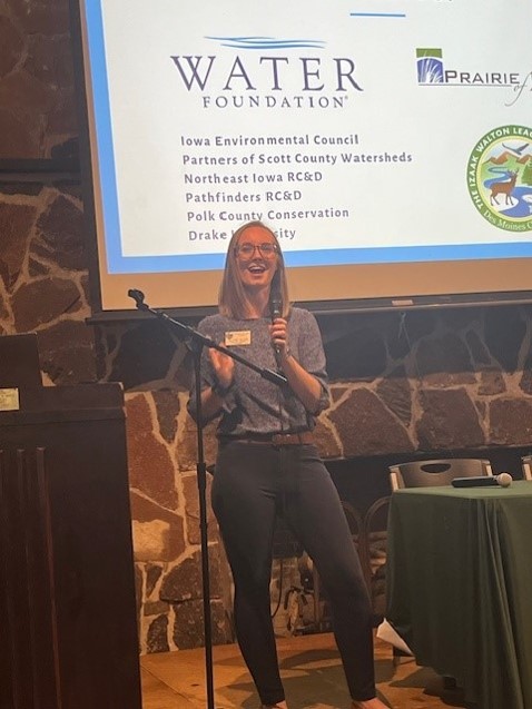
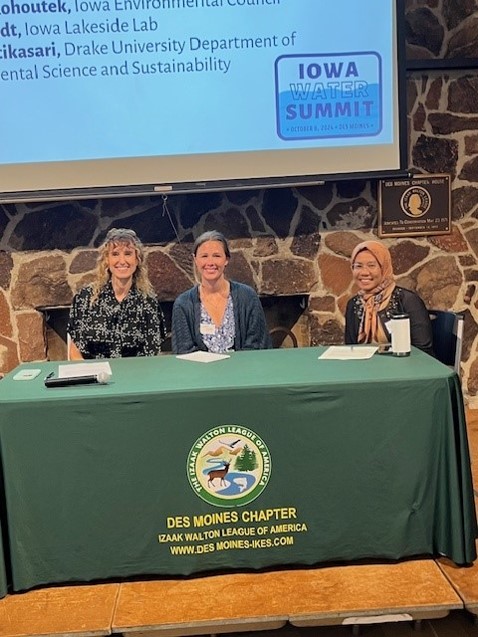
The Iowa Water Summit on October 8 brought together 65 people with an interest in water monitoring for a day of learning and networking. The event was one outcome of the grant from the Water Foundation that Prairie Rivers of Iowa was awarded last year and the regular meetings we’ve been having with seven partner organizations. The Des Moines Chapter of the Izaak Walton League made their facilities available and Heather Wilson (Midwest Save Our Streams Coordinator for the Ikes) did the lion’s share of the planning. Thanks to our presenters, to Bud Hartley for taking these photos, and everyone who helped make the event possible!
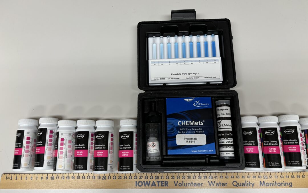
Planning events, dipping test strips, identifying and counting benthic macroinvertebrates, shocking fish, incubating bacterial plates, calibrating equipment, maintaining databases, analyzing data, communicating with the public… There’s a lot of work that goes into finding out what’s in our lakes, rivers, and streams! Between the Water Summit and my 8 years (!) working for Prairie Rivers of Iowa, I’m starting to assemble a picture of the organizations that do water monitoring and where to find the data they collect. Even so, this will not be a complete list! Feel free to add some more in the comments!
State and federal agencies
State and federal environmental agencies do a lot of water monitoring and have a lot of expertise, so if you’re looking for data, your first stop should be one of these databases.
BioNet houses fish and macroinvertebrate surveys collected by the Iowa Department of Natural Resources and the State Hygienic Lab. If you want to know which streams support stoneflies or whether biological diversity has declined in a certain creek, this is the place to find out.
How’s My Waterway is a convenient way to access data submitted to the Environmental Protection Agency from both state and local partners. For example, IDNR uploads their data once a year, while Polk County Conservation uploads their data once a month. EPA’s old system was called STORET, but now it’s the Water Quality Portal for downloads and the Water Quality Exchange for uploads.
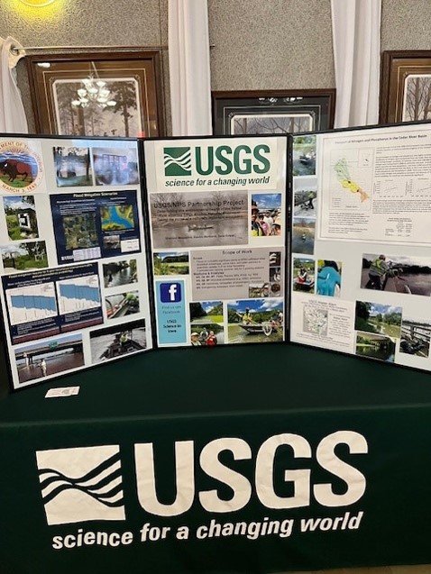
The National Water Dashboard provides access to the US Geologic Survey’s network of stream gages, essential information if you live on a floodplain, if you’re planning a canoe trip, or if you need some context to make sense of your water quality data. The USGS also does quite a bit of water quality monitoring, in partnership with the EPA—the National Rivers and Streams Assessment is the best water quality study you’ve never heard of.
Volunteer programs
Iowa has too many waterways for the agencies to monitor on a regular basis, so if you want to know about water quality in your local creek, you may have to do it yourself. Fortunately, since the end of the IOWATER program, other organizations have stepped up to provide volunteers with equipment, training, and a place to store the data.
Polk County Conservation has a very impressive monitoring program, based on the IOWATER protocols, with data housed on the EPA’s Water Quality Portal. Staff, partners and public volunteers monitor 70 sites twice a month. Partners include Des Moines Water Works, the Cities of Altoona, Ankeny, Des Moines, and West Des Moines along with Des Moines Parks and Recreations and West Des Moines Parks and Recreation.
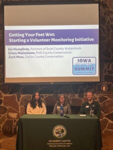
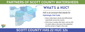
Partners of Scott County Watersheds is one of several organizations with a watershed or regional focus that organize big volunteer monitoring events (snapshots) two or three times a year. They have created their own database and online dashboard to view the results.
Trout Unlimited has been encouraging anglers in the driftless area to monitor water quality with a test strip and mobile app.
Watershed Projects and Agriculture
Prairie Rivers of Iowa originally got involved in water monitoring to educate the public about the Ioway Creek watershed and track conservation efforts in that watershed. Many watershed projects incorporate water monitoring for one or both of those reasons. A typical approach is to collect water samples once or twice a month during the growing season (plus some samples after heavy rains) and send them to a certified lab for analysis. In our case, that’s a lab operated by the City of Ames water and pollution control department, but others watershed projects have partnered with a university or commercial lab.
Have you seen “Moved by Waters?” The documentary by Fourth Wall Films showcases the conservation, education, and citizen science work that Partners of Scott County Watersheds is doing in the Quad Cities and surrounding farmland. In addition to snapshot events they have a long history of research to try to track down sources of bacteria. Our grant helped them do one more round of microbial source tracking; Vice-Chair Steve Gustafson shared preliminary findings at the Water Summit but it wasn’t straightforward!
The Iowa Soybean Association has supported nutrient sampling of streams and drainage tiles for some 19 watershed projects around the state. The Lower Skunk River WQI project is a good example of that—Pathfinders RC&D collects water samples that are sent to the Iowa Soybean Association for laboratory analysis. Several soil and water conservation districts and agribusiness groups are also partners on the project. Since the ISA collects many field edge samples that come with some privacy concerns, they don’t have a publicly accessible database. However…
Agriculture’s Clean Water Alliance has worked with ISA to monitor nitrate in the Raccoon River, Boone River, and Beaver Creek watersheds. They post annual reports going back decades.
Northeast Iowa RC&D has been coordinating water quality monitoring in the driftless area for 25 years, as described in this article. They have created a nice data dashboard for the Upper Iowa River watershed and the Upper Wapsipinicon River watershed.
Colleges and Universities
The Iowa Water Quality Information System is an amazing map that shows you real-time data from a network of nitrate sensors operated by IIHR (Hydroscience and Engineering at the University of Iowa) and the USGS.
Marty St. Clair (formerly of Coe College, now at University of Iowa) and his students have done sampling and laboratory analysis to support the Middle Cedar River, Indian Creek, Upper Iowa, Turkey River, Maquoketa River, and Upper Wapsipinicon River Watershed Management Authorities.
Drake University’s environmental science department has done stream monitoring to support watershed projects and water recreation in Polk County. It’s often a challenge to maintain access to data that’s collected for student projects, but a solution is in the works.
Iowa State University researchers have done a lot of the field scale and edge-of-field monitoring that established the effectiveness of conservation practices including riparian buffers, saturated buffers, bioreactors, and CREP wetlands. ISU is also responsible for tracking various progress indicators for the Iowa Nutrient Reduction Strategy, including compiling water quality data from IIHR, DNR, and USGS.
Closing Thoughts
Finally, there are organizations that don’t collect data themselves, but help make the other data more accessible to the public. The Iowa Environmental Council sends out a Weekly Water Watch newsletter to provide updates on beach monitoring by Iowa DNR, and they’ve been advocating for standardized, easily accessible, user-friendly data.
That’s an idea I support, and there are people working toward an “Internet of Water.” However, I am a bit skeptical when I hear people say “why don’t you use AI” or “you should really get all this data in one place.” Have you ever tried downloading data from the EPA’s Water Quality Portal that was sourced from more than one organization? I have, and I eventually got something useful out of it, but first I had to delete 20 unused columns and then I had to shorten the column names and then I had to clean up the non-numeric entries that one organization had put in a numeric field, and then I had to filter out the sites where monitoring too sporadic to be representative. Bigger, more flexible systems have their drawbacks.
I am more excited about building relationships and improving communication among the various people who care about water quality and who are involved in monitoring, so we can learn from each other and avoid duplication of effort. Hopefully, the Iowa Water Summit and this article are a step in that direction!
For 18 years, staff with the Iowa Department of Natural Resources trained and equipped volunteers to test water quality in rivers and streams across the state, building a network of citizen scientists and conservation leaders in the process. The IOWATER program died in 2016 after a long battle with budget cuts, declining participation, and IT challenges. It is survived by the state’s largest river cleanup event (Iowa Project A.W.A.R.E.) and many volunteers who resumed or started monitoring with the support of the Izaak Walton League, county conservation departments, watershed coalitions, and local non-profits.
The first Iowa Water Summit in 2019 was a sort of a funeral for the IOWATER program and a passing of the torch to the Izaak Walton League’s Save Our Streams program. Several groups in Iowa are making good use of the Ikes’ online database, trainers and training materials, and extra supplies. However, stream monitoring in the post-IOWATER era is decentralized and locally-led. Prairie Rivers of Iowa thought we could all benefit from more collaboration, so we wrote a grant proposal that was funded by the Water Foundation. Over the past year, I’ve been meeting regularly with colleagues from the Iowa Environmental Council, Northeast Iowa RC&D, Pathfinders RC&D, Partners of Scott County Watersheds, Polk County Conservation, and Drake University to talk about water monitoring, lay the groundwork for some new tools, and help the Izaak Walton League plan a second Water Summit.
The second Iowa Water Summit (scheduled for Oct 8 in Des Moines) is an opportunity for anyone involved in a local monitoring program (or looking to start one) to come together and learn from the experience of others around the state. We’ll have time and space for displays and networking. We’ll have a panel about recruiting and retaining volunteers. We’ll have a talk about making sense of the data once you have it, and another about new methods like microbial source tracking. We’ll have a panel about communicating with the public and turning data into action. If you’re at all interested in water quality and water monitoring in Iowa, don’t be shy! Register before September 20!
The other legacy of IOWATER is less trash in our rivers. Iowa Project A.W.A.R.E. was started in 2003 by IOWATER coordinator Brian Soenen, who now serves on the board of a non-profit that continues the tradition. This year, 269 volunteers in canoes removed and recycled 3.8 tons of trash from 60.2 miles of the Skunk River.
This was my first year participating in the cleanup and I highly recommend it! In addition to the fun of being on the water and the satisfaction of leaving the river cleaner than you found it, I enjoyed good food, friendly people, and interesting evening nature programs, including live turtles and a dugout canoe!
A.W.A.R.E. stands for A Watershed Awareness River Experience, and I tried to raise some watershed awareness in my Monday afternoon talk about the hydrology and water quality of the Skunk River. For example:
The Skunk River starts near Blairsburg and joins the Mississippi River near Burlington after a journey of 274 miles. By that point, it drains more than 4000 square miles of central and southeastern Iowa.
Thunderstorms in the Ames area lead to a rise in water levels at Augusta eight days later.
Rain that falls in the watershed can reach streams quickly if it runs off the surface or travels through storm sewers or drainage tiles, but moves more slowly if it’s caught by ponds and wetlands or soaks into the ground. Some of the water entering Ada Hayden Lake in Ames showed chemical signatures of having been underground for more than 50 years!
Watershed characteristics can help explain water quality patterns in the Skunk River and its tributaries, as shown in this table. For example:
The North Skunk River watershed has steeper hills, so has higher turbidity levels. The South Skunk River watershed is flatter with more tile-drained cropland, so has higher nitrate.
The Skunk River receives effluent from 9 major wastewater treatment plants (Ames, Newton, Nevada, Mt. Pleasant, Grinnell, Fairfield, Oskaloosa, Washington and Montezuma) and 85 smaller systems, which contribute to higher phosphorus levels.
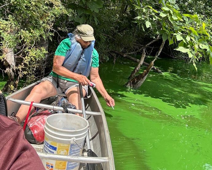
However, the most memorable and sobering lesson about watersheds was taught by Lake Darling. We camped three nights at the state park, and I had an opportunity to explore it on Monday when high water levels kept us off the river. Lake Darling State Park has a lot going for it: a large lake in a beautiful setting, with an active Friends group that has improved trails and facilities. But the water quality is appalling. During my visit, the beach had a warning sign posted due to high levels of microcystin (a toxin produced by blue-green algae). I have never seen water this green. It looked like a kale smoothie and smelled like manure.
What happened? In 2007, Iowa DNR was celebrating Lake Darling as a success story, after most farmers in the watershed participated in a program to control erosion and intercept runoff. A $12 million project to drain and restore the lake was completed in 2014. By every indication, these efforts were successful at reducing the amount of sediment entering the lake. However, other water quality metrics (orthophosphate, E. coli, and microcystin) have gotten worse. The most likely explanation is the manure from 30,000 hogs. Nine animal feeding operations have been built in this watershed since the park reopened. I calculated the density of livestock in Lake Darling’s watershed (598 animal units per square mile) and found that it’s highest of any lake in Iowa, and higher than all but a handful of rivers.
This is why it’s not enough to measure success by dollars of cost share spent or the number of practices installed. We need to be aware of both positive and negative influences on the water bodies that we care about, and we need to test whether water quality is actually improving. At the Iowa Water Summit, I’ll share some tools and tips for doing just that. Hope to see you there!
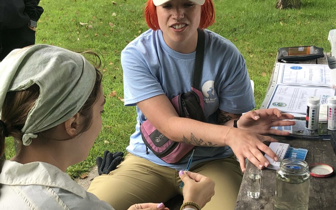
Monitoring a stream once or twice a month is a big commitment, but our locally-led water monitoring program (which started in Story County but has expanded to Hamilton County) has no shortage of committed volunteers! The following metrics show the continued growth of the program in size and consistency.
Also, let’s give a shoutout to the people who work behind the scenes to make it happen! Sara Carmichael of Story County Conservation keeps everyone on track and equipped with supplies. Heather Wilson of the Izaak Walton League of America helps train volunteers and has been leading up the new Nitrate Watch initiative. We rely on the IWLA’s Save Our Streams program for training materials and the Clean Water Hub for data entry. In addition to volunteer monitoring, Maryann Ryan and her team at the City of Ames Laboratory Services Division process weekly samples from 3 sites and monthly samples from 15 sites.
2022 Season
Volunteers participating
Sites tested at least once
Sites tested at least 20 times
Data sheets entered in the Clean Water Hub
2023 Season
Volunteers participating
Sites tested at least once
Sites tested at least 20 times
Data sheets entered in the Clean Water Hub
In March, Prairie Rivers will release a report detailing the findings. Here are a few preliminary numbers that give a sense of how 2023 stacks up to the previous year.
2022 Season
Weeks in Drought
E. coli (geomean) at best site
E. coli (geomean) at worst site
%
"Poor" readings in Clean Water Hub
2023 Season
Weeks in drought
E. coli (geomean) at best site
E. coli (geomean) at worst site
%
"Poor" readings in Clean Water Hub
Drought continues to limit where we have flowing water. Sometimes, most of the water in a creek is coming from sewage treatment plants, which are able to remove some pollutants but not others. E. coli bacteria (an indicator of fecal contamination) continues to be high in most waters, likely coming from multiple sources. Looking at E. coli averages (geometric means) for the 2023 recreation season, two swimming beaches in the county met the primary contact recreation standard (126 colonies/100mL) but only 1 of 14 streams with enough data to evaluate did, and three exceeded the secondary contact recreation standard (630 colonies/100mL). Due to restrictive state laws about “credible data”, these sites might appear on a list of “Waters in Need of Further Investigation” but won’t be counted on the 2024 Impaired Waters List.
We continue to work with partners locally and around the state on ways to interpret water quality data and make it more accessible.
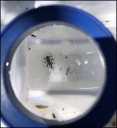
In April, I joined a class of Ames High School seniors to survey benthic macroinvertebrates in Ioway Creek. If you had asked me “what on earth are you doing?” here’s what I would have said:
Hello! I’m Dan and I work on water quality for a local non-profit. And these are environmental science students from Ames High School. Why are we standing in the middle of the creek wearing hip waders and doing what looks like a funny dance? Why, this is a perfectly normal thing to do! We are citizen scientists and we are “science-ing”! The dance is called the benthic shuffle, and is an important part of the protocol for biological monitoring. We are dislodging aquatic insects from the rocks and catching them in our net.
And look at what we have caught from a mere 1 square meter of rocks! 170 mayflies! This too is normal! We are at Brookside Park, and here is a brook babbling over rocks and gravel. It would be strange if we did not find a healthy population of mayflies in such inviting habitat!
No, they don’t look like the mayflies that spatter windshields in Dubuque. But this is indeed Baetis, the blue-winged olive mayfly, imitated with success by many a trout fisherman. In its larval form, we call it the “small minnow mayfly”, for its quick swimming. They live about a year in the creek before they pupate and get their wings, assuming a fish doesn’t eat them first!
As I was saying, what you see here is perfectly normal, though maybe not as common as it should be in Iowa streams. If you find a riffle in the stream with no mayflies, well, that would mean something is not right. Perhaps insecticides have washed into the creek from upstream farms and lawns and killed them. Perhaps we’ve inadvertently fertilized the algae in the creek, turned the water a shade greener and the making the water a little less oxygenated at night. There are other insects that can make a living under these conditions. In the creek near the Story County Fairgrounds, you can find plenty of these net-spinning caddisflies, but no mayflies! If all you find are these wriggly little midge flies, well, that’s a sign of more serious pollution.
Nice to meet you! Time to get back to counting bugs!
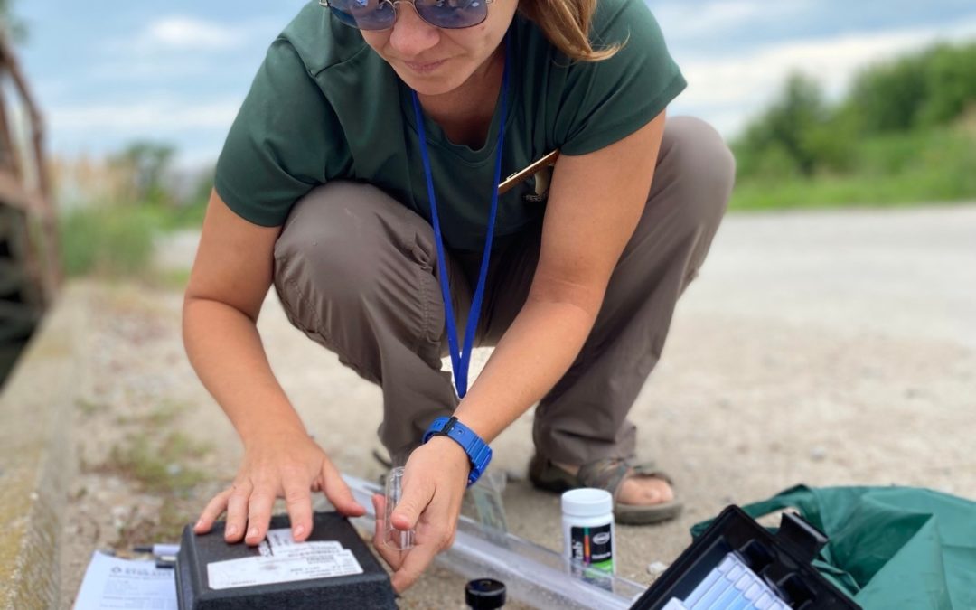
Jess Lancial testing water quality (photo credit Story County Conservation)
Volunteer Water Monitoring in Story County
A round of applause for all the volunteers and Story County Conservation staff who have diligently been monitoring their assigned stream twice a month in all kinds of weather! Also, let’s give a shout-out to the people who work behind the scenes. Sara Carmichael of Story County Conservation keeps everyone on track and equipped with supplies. Heather Wilson of the Izaak Walton League of America provides training and support to volunteers around the state. We rely on the IWLA’s Save Our Streams program for training materials and the Clean Water Hub for data entry. The three of us will be meeting the volunteers at a training event later this month to kick off another great season.
Three ways to get involved:
There’s room for one or two more volunteers to cover a site in Story County, so contact Sara.
If you’d like to try water monitoring without committing to a schedule, Prairie Rivers organizes a one-day volunteer event in the Ames area each May, so keep an eye on our events page.
If you don’t live in Story County, the Izaak Walton League is launching a new Nitrate Watch program and you can request a bottle of test strips while supplies last.
In March, Prairie Rivers will release a report detailing the findings, but for now let’s admire the scale and consistency of the effort, which has really improved since last year. (Updated 2023-02-18 to include some data sheets that were entered late)
2022 Season
Volunteers participating
Sites tested at least once
Sites tested at least 10 times
Sites tested at least 20 times
Data sheets entered in the Clean Water Hub
2021 Season
Volunteers participating
Sites tested at least once
Sites tested at least 10 times
Sites tested at least 20 times
Data sheets entered in the Clean Water Hub
Story County Water Monitoring & Interpretation Plan, 2021-2030
Prairie Rivers partnered with Story County and 8 other organizationsto develop a ten-year Water Monitoring & Interpretation Plan for Story County. Regular communication between the various groups testing water helps avoid duplication and leads to new opportunities to improve water quality. Planning for how data can be used over the long term ensures that we get the most value from our time and effort. Read the plan here.